
Technical plans
Execution plans and study files
Documents techniques réalisés sous DWG et QGIS, structurés pour être exploitables directement par les professionnels du bâtiment et de l'aménagement.
The context
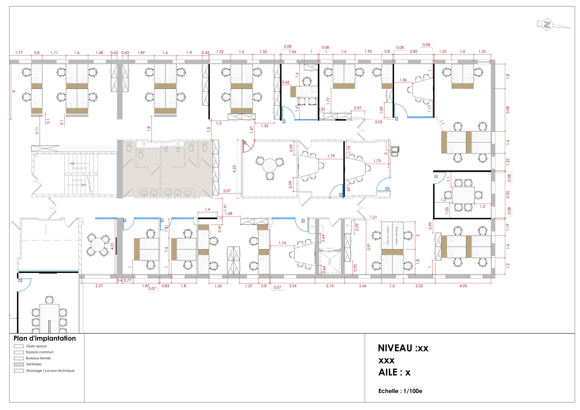
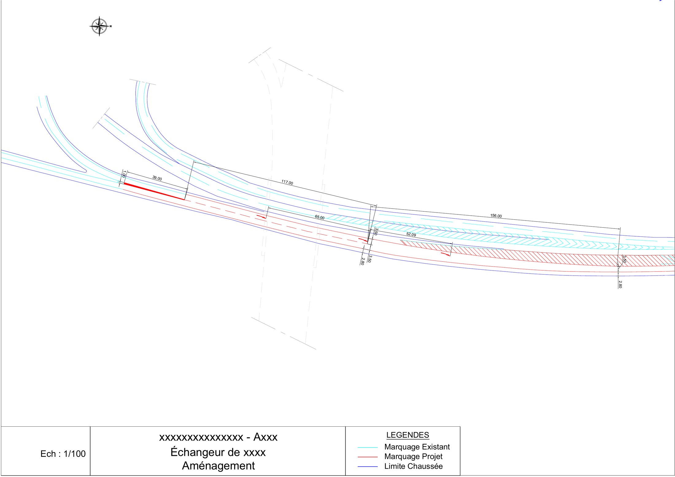
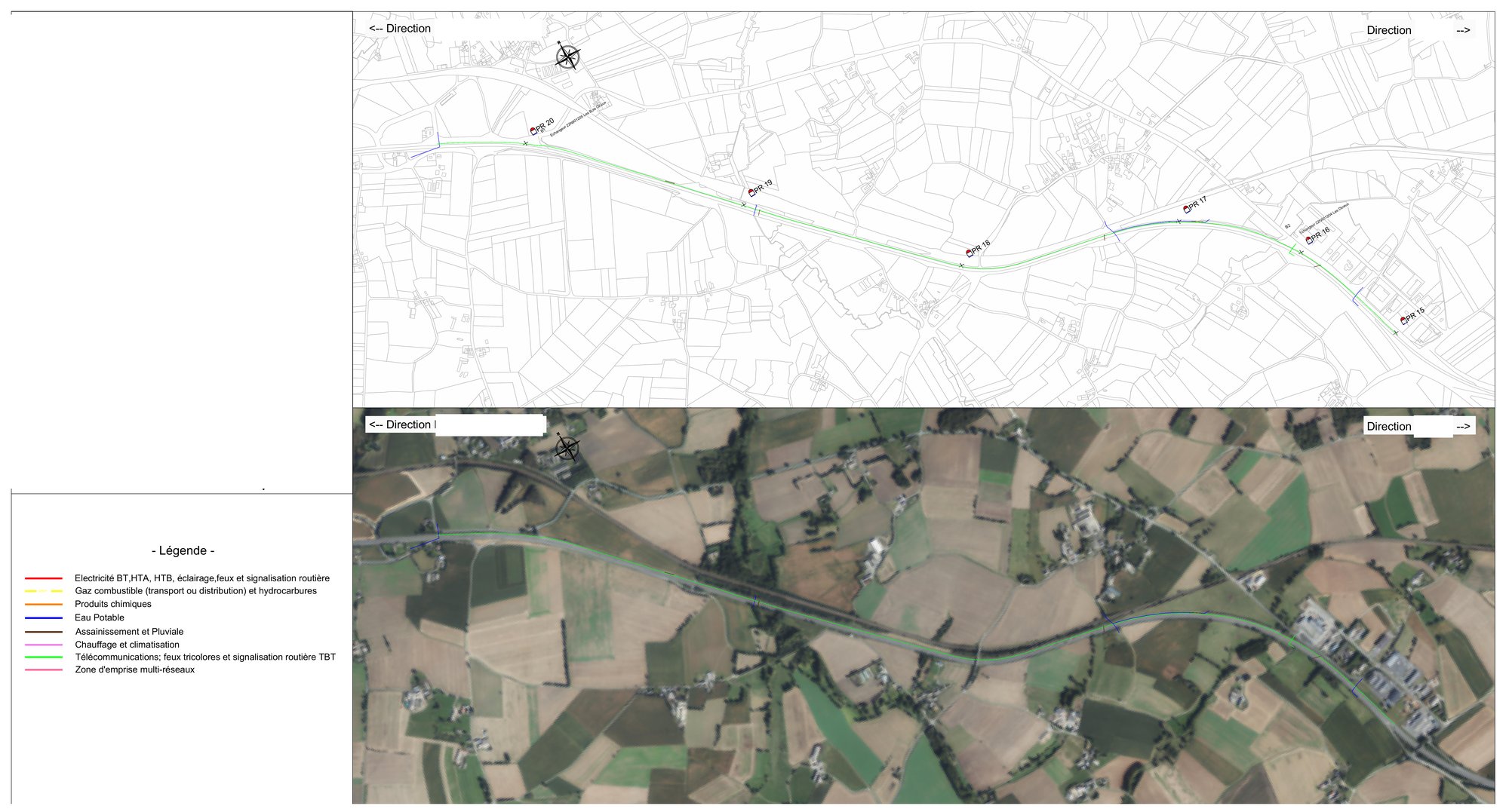
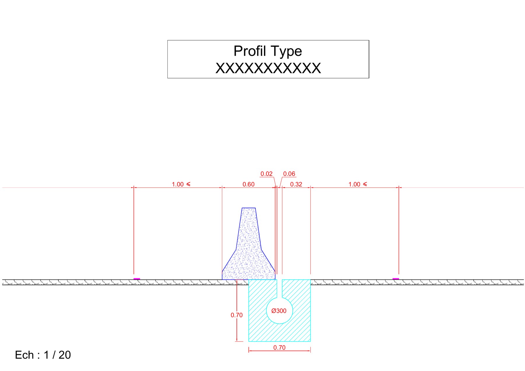
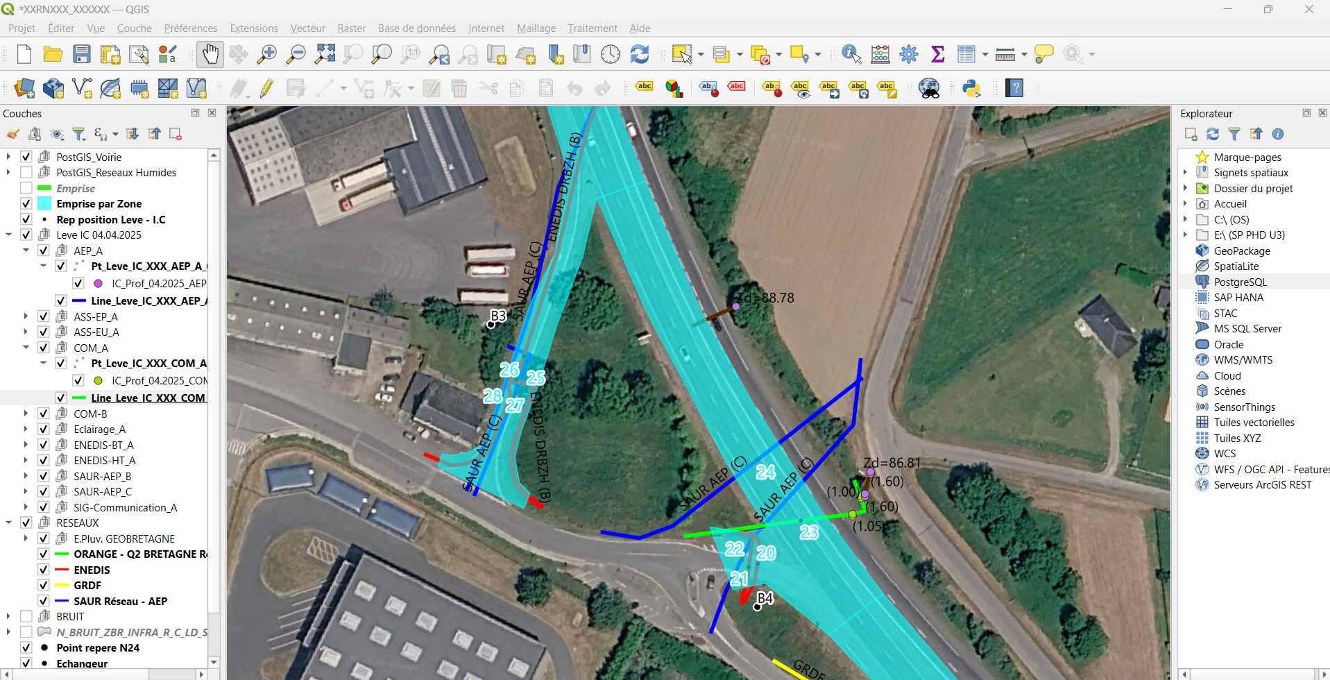
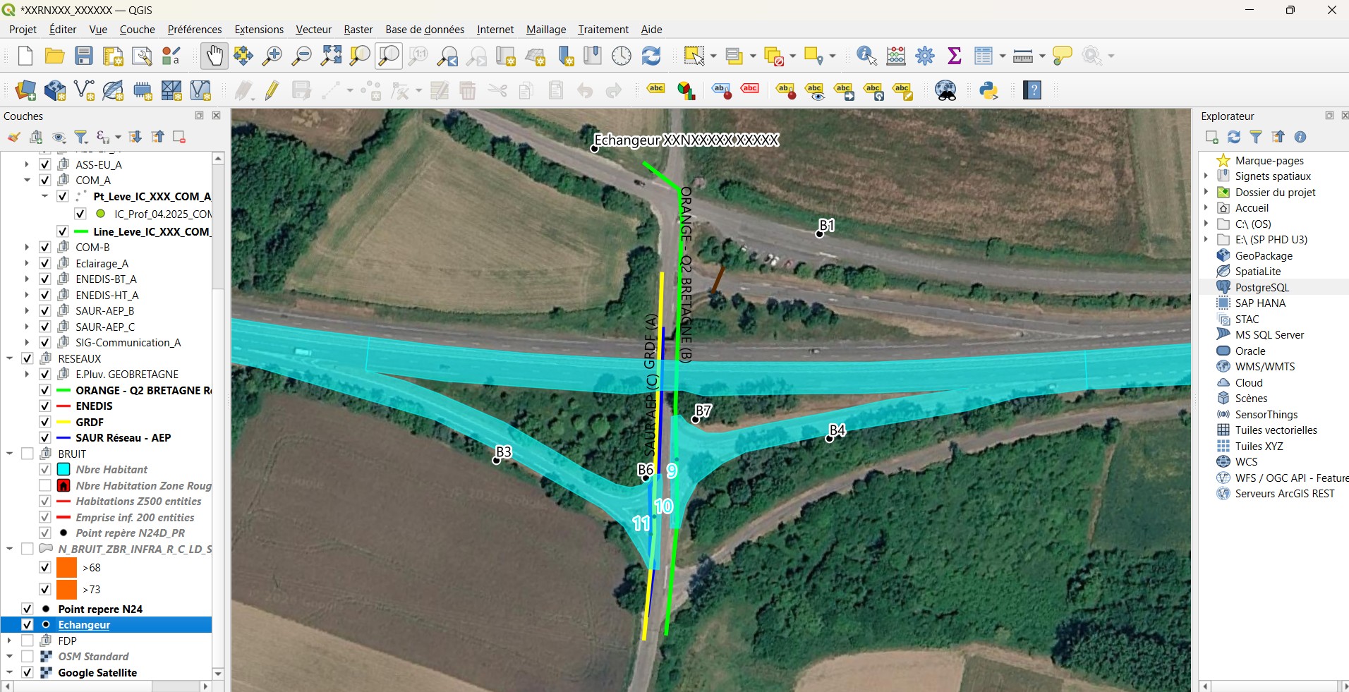
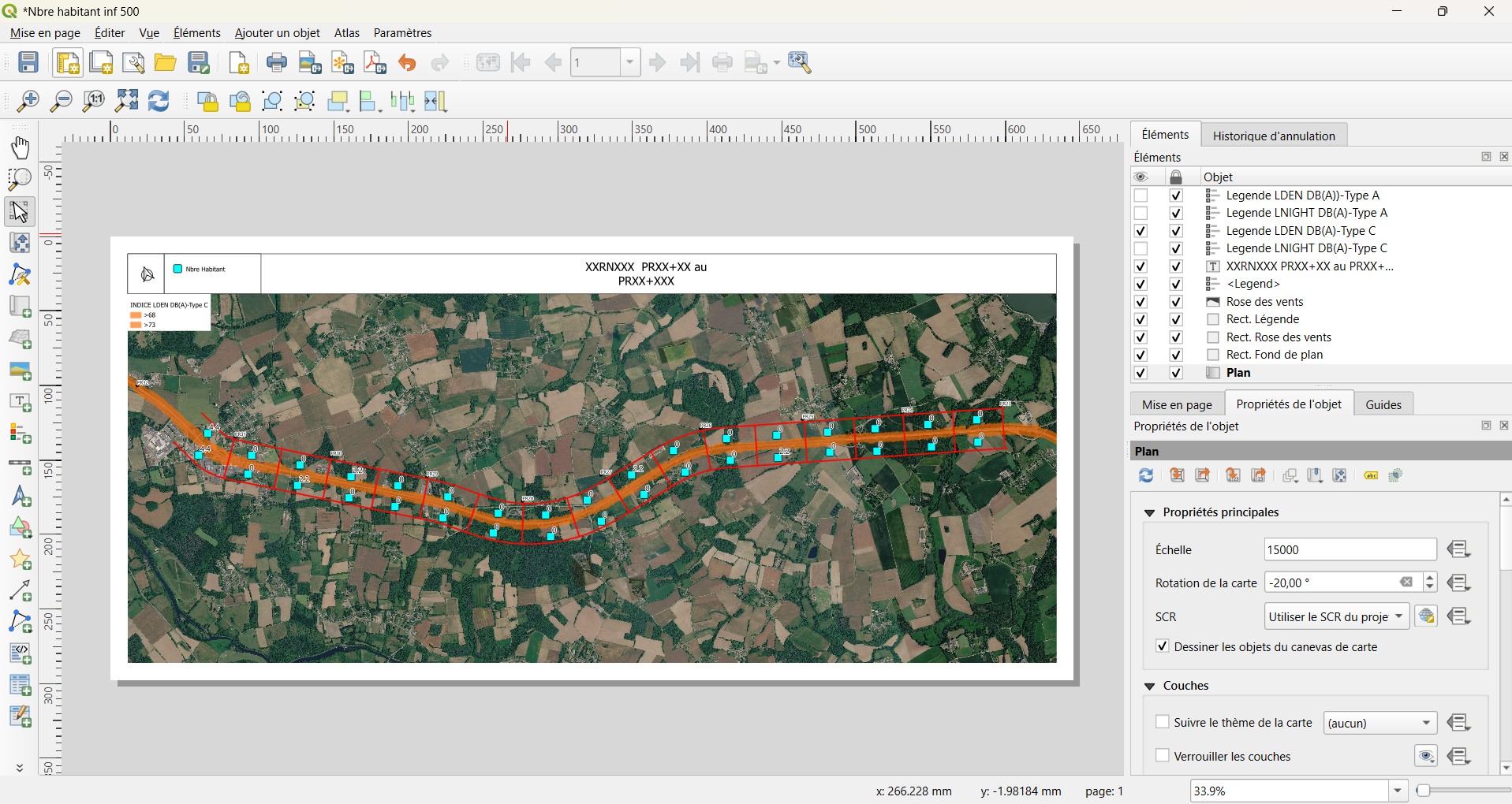
Cet exemple présente la production de plans techniques exploitables directement par les professionnels : architectes d'intérieur, agenceurs, artisans ou bureaux d'études. L'objectif est de transformer des relevés ou des intentions de projet en documents précis, clairs et prêts à l'usage.
The process
À partir des informations disponibles (relevés, mesures, références), les plans sont construits et mis au propre sous DWG, avec un travail complémentaire sous QGIS lorsque le projet implique une dimension géographique ou cartographique.
Documents produced
- Plans d'aménagement
- Sections and elevations
- Mise au propre de relevés existants
- Documents exploitables, prêts à être partagés ou imprimés